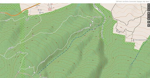
We use open-source mapping tools in the field for the master plan and schematic phases of projects. These tools enable us to track both current and proposed trail alignments, record points of interest, note design opportunities, and identify potential hazards. These location-specific notes are shared with our team members, consultants, and stakeholders so each person has the ability to contribute to and modify this dataset. We then integrate this detailed, on-site information into our inventory, analysis, and design workflows.
We beta-tested these tools and methods for the Shuamta Gateway Tourism Master Plan in the fall of 2022. The master plan project was funded by The USAID Economic Security Program, on behalf of partner beneficiaries Alaverdi Eparchy and Badagoni Wines. The plan specifies improvements and new tourist facilities and programs in the area surrounding the Shuamta Monasteries near Telavi.
Shuamta (შუამთა) in Georgian means “between the mountains.” The Old and New Shuamta monasteries are located between the Gombori Pass and the Alazani Valley in Kakheti, Georgia. The landscape surrounding the monasteries features thick beech and hornbeam forests, expansive dry river washes, and stunning views of the greater Caucasus mountains.
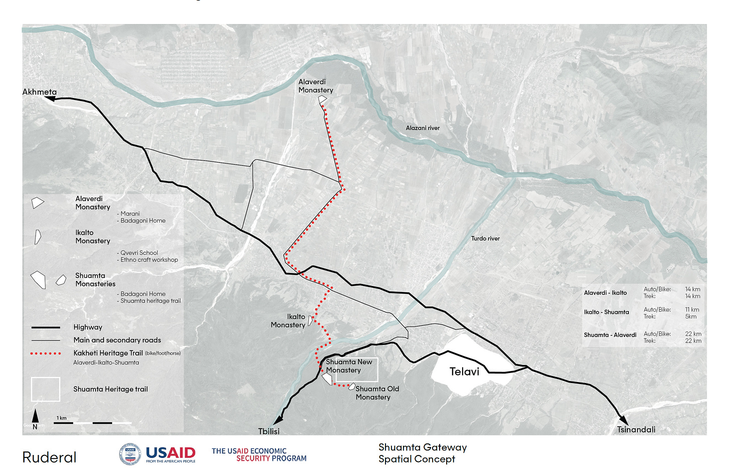
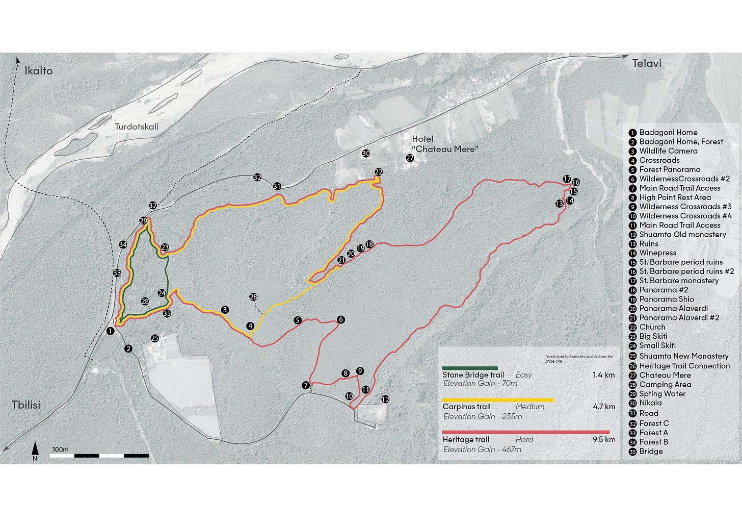
One of our tasks involved planning and detailing two complementary trail systems and their key attractions. The first is a regional tourist trail, connecting the significant landmarks of Alaverdi and Ikalto Monasteries to the Shuamta complex. The second is a set of hiking trails that traverses the forestland and archaeological sites surrounding the Shuamta Monasteries. In this post, we describe the methods and tools used to create a trail master plan for the Shuamta Complex, and how these tools can be used in future landscape planning and design projects.
The Big Picture: Connecting the Monasteries of Shuamta, Ikalto, and Alaverdi
Today the “Heritage Trail” connecting the Alaverdi, Ikalto, and Shuamta monasteries is an automobile route. The future plan is to connect the monasteries via overland hiking trails with campsites. The beneficiary team asked Ruderal to map existing footpaths within the Shuamta forest and develop circuits of different lengths, to connect to the Heritage Trail eventually.
The proposed trails in the Shuamta Forest will guide tourists through the monastery landscape and its history. The trail system begins at a new “Gateway Hub,” a trailhead with tourist facilities. The trail attractions include shrines, woodland chapels, overlooks, and historic caravan road artifacts like bridge abutments.
The Detail: Tracing Footpaths and Points of Interest in the Forest
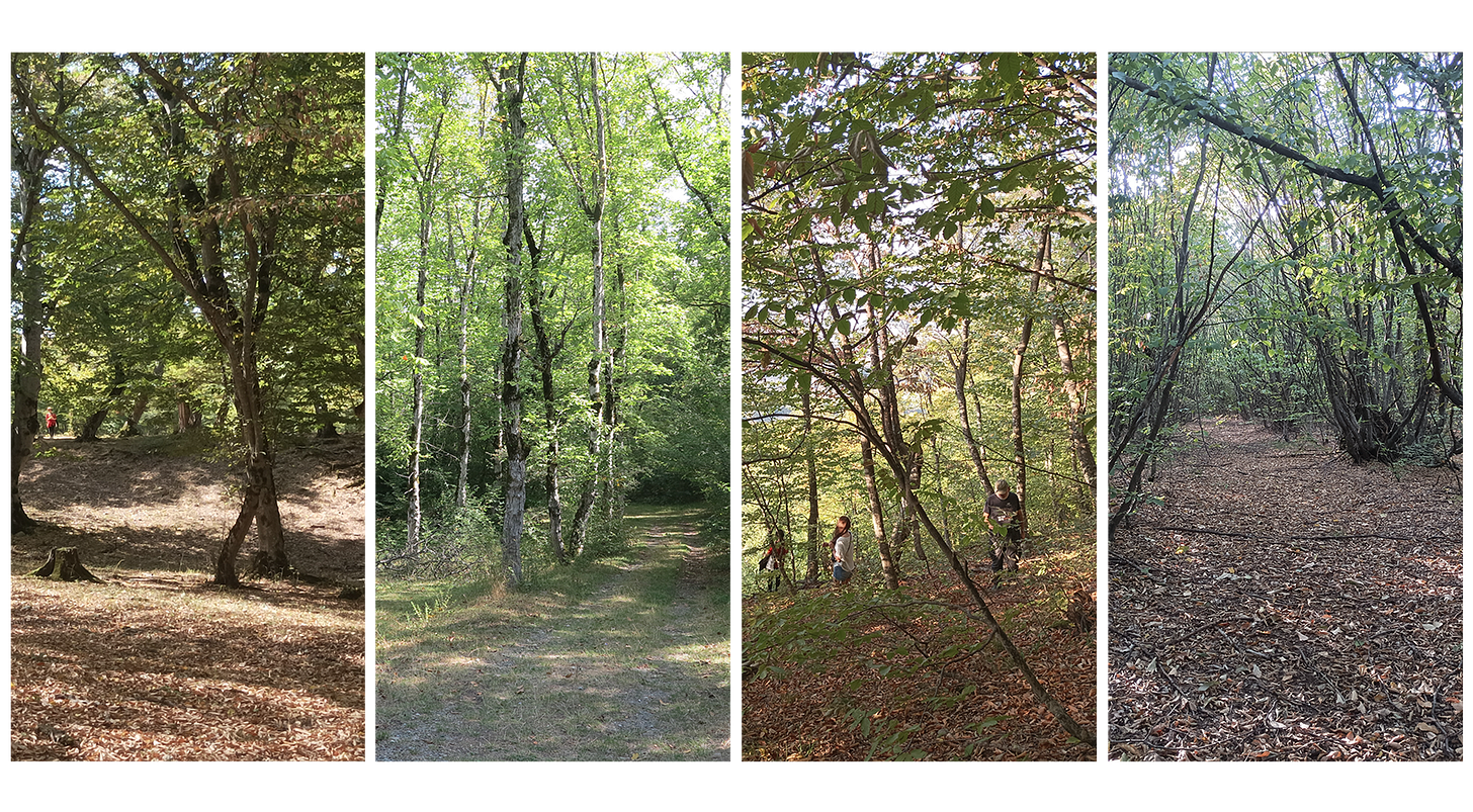
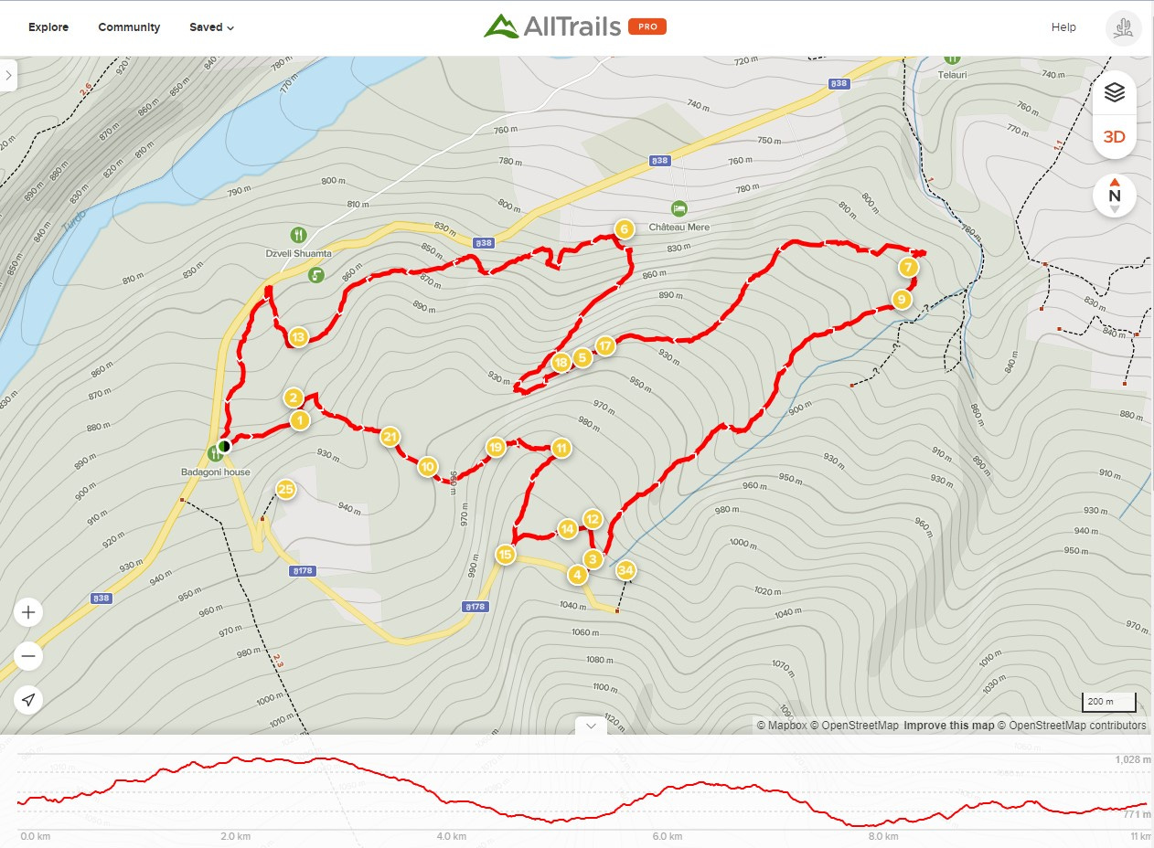
Our partners provided us with a .KML file of a route through the forests and several points of interest. Luka and the team followed the path and verified the points of interest using All Trails app via a .GPX file, the preferred file format for integration with Open Street Map. They noted areas for further attention in the schematic design, such as sites for benches, areas with scenographic potential, and difficult grades, hazards, and erosion areas needing further attention and adjustment.
Analyzing the Data
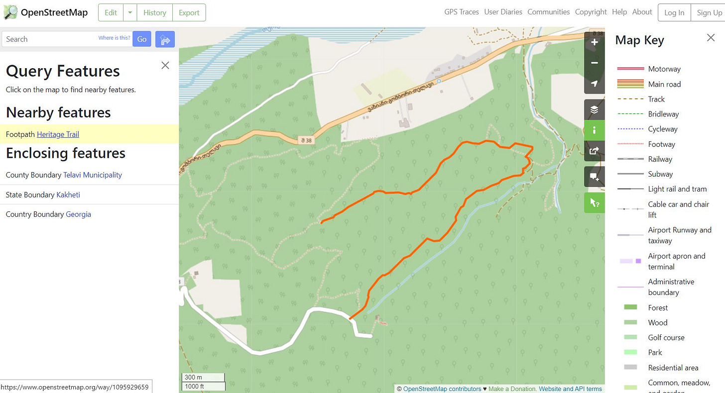
The next step involved analyzing, synthesizing, and re-generaitng the trail data. We decided to split the longer trail into three distinct circuits within the forest, with different lengths and themes. We outlined the list of enhancements—with safety and clarity being a priority—and made an initial cost estimate for the beneficiary team. Using Open Street Map, we uploaded the .GPX file, re-generated the tracks, split them into named circuits, and added more detail to the historical points of interest data fields. Today, users can query the points in the app and follow the trail, although no improvements have been made to date.
Integration in Master Plans and Participatory Design
We see greater integration of tools and apps like All Trails and Open Street Map in our work developing tourism and landscape master plans, as they allow for low-cost, accurate field notation and measurement of existing and proposed landscape elements. OpenStreetMap allows for wider dissemination of this information, which can lead to a more collaborative and informed approach to public landscape development. For example, community members can be trained to use these tools to map points of personal or shared interest, or areas needing attention in a given landscape.
If you’re interested in learning more about the specific tools and workflows, contact Luka at tavzarishvili@ruderal.com


